


Neo-Korinth (New Corinth)
Comparisson reports are under license of:

Lo que dice el Arxiduc:
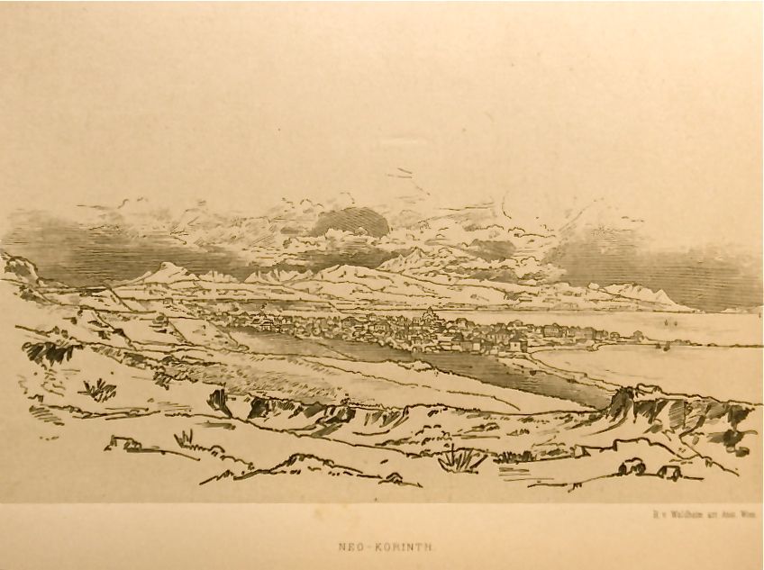 “Where the isthmus starts, a few feet from the sandy coast, we come to the town of Neo-Korinth which was founded a few years after the terrible earthquake in 1858 which destroyed Archaia Korinthos (Old Corinth). Approximately 300 families live there. The houses on the scala are protected by a series of earthen hills, and gray-white chalky marl. The hills rise up out of the isthmus, above a flat surface, rounded towards the west, forming a small point. The town is built at a right angle and has five streets running parallel to the gulf and seven transversal ones […]. The streets are broad, and some have mulberry trees. The generally single-family homes give you a sense of entering a town that is unfinished.”
 “On the sandy shore towards Loutraki where some reeds grow and where there’s a large café with fabulous painted figures of boats is a small dock, the habitual wharf. There’s another one further down next to the sanitá. You can anchor on one side or another depending on the winds. In front is a larger and isolated dock with a small lighthouse on the end. It lights up only on nights that a steamship is expected. This dock offers little protection because the waves leave when the winds blow strong from the west. Larger ships cannot anchor here, and smaller ones have to do so carefully to avoid the not-very-deep and sandy beach to the east in bad weather.”
Datos proyecto Nixe III:
Corinth is located in a strategic spot, earning it a special place in history. Today, however, that historical position is relatively less important than in the past.
As the Archduke mentioned, a strong earthquake led to old Corinth being abandoned. It’s where the main archeological remains can be found. People moved to a new location near the sea. The port is still relatively small and fairly exposed to winds from the west. In addition, the undertow still affects the boats mooring there.
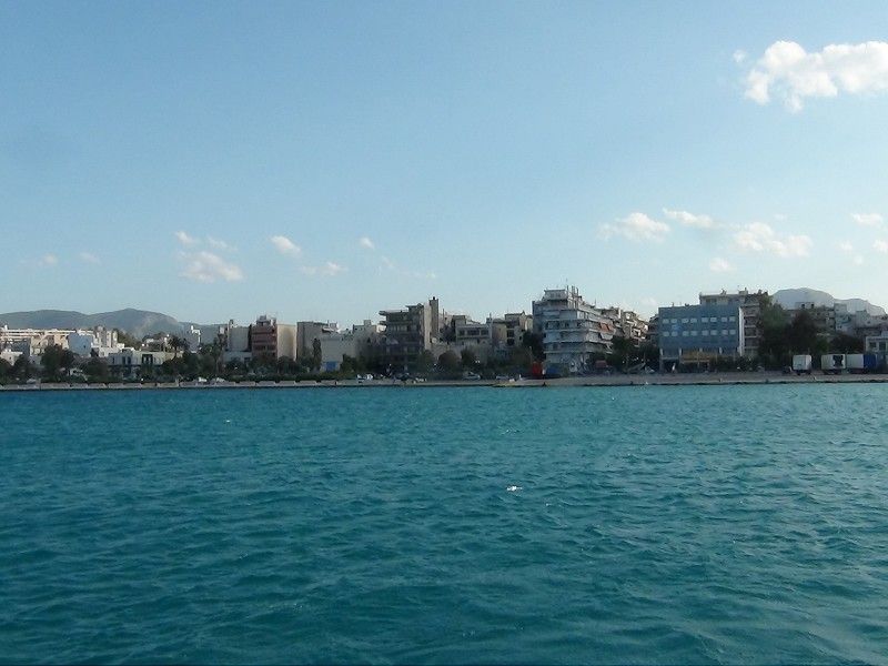
As we enter from the sea, we can see the new Corinth. Our photo coincides with the Archduke’s engraving. Upon landing, we can see the same layout with the broad streets. This grid pattern is typical of that found in the new colonial cities built during the 19th century. It reminds us of the cities the French built in Northern Africa, for example, in Sfax and Tunis.
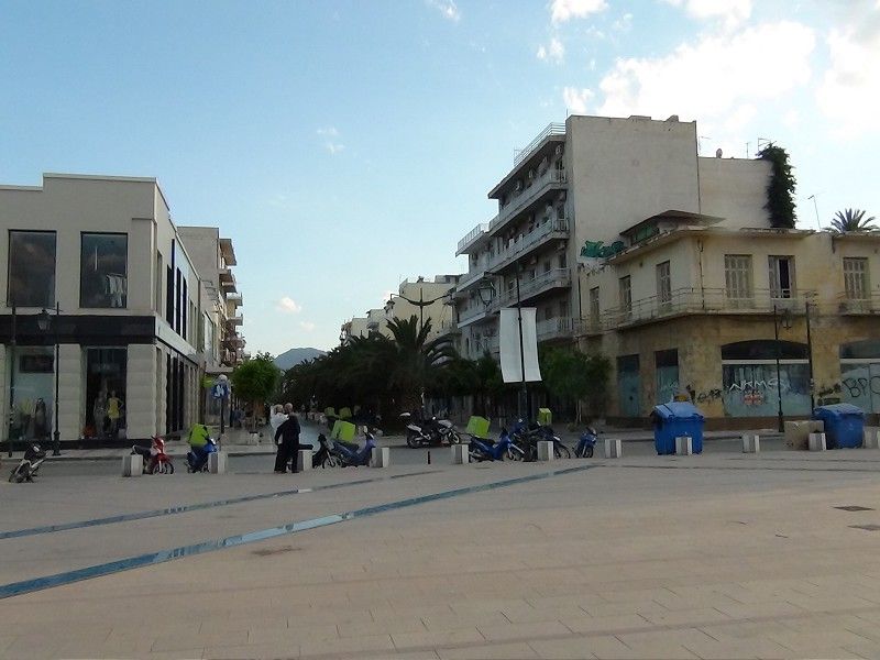
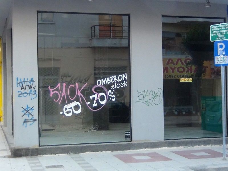
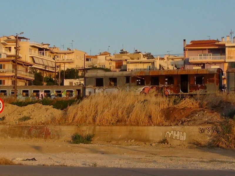
We can clearly see the effects of the current economic crisis in the city of Corinth. A lot of shops are closed, and there are a lot of train cars abandoned on the tracks near the boardwalk.
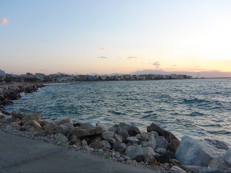
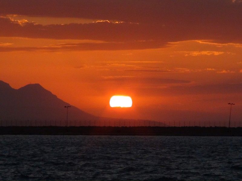 From this same boardwalk, we take an image of the city towards the port. Turning back, we see a beautiful sunset and can make out the Peloponese mountains in the photo on the right.
Comparisson reports are under license of:


